

Channel Park is located on Huichin territory, ancestral and unceded land of the Chochenyo-speaking Ohlone people, at the edge of West Oakland on the channel dividing the city from Alameda Island. This channel leads to Lake Merritt, the Bay Area’s only actively maintained tidal lagoon. Lake Merritt is also home to California’s first official wildlife refuge and familiarly known as the heart and energy of downtown Oakland.
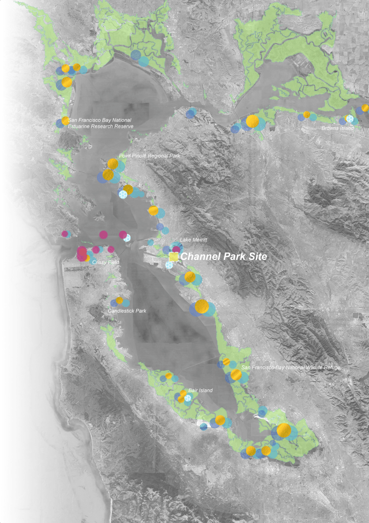
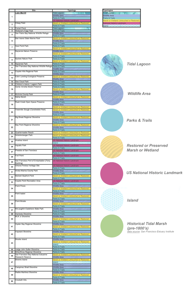
In a study of 50 parks across the San Francisco Bay, Channel Park presents itself as the first of its kind to offer trails, restored marsh land, wildlife habitat, and connection to a uniquely significant landmark that is Lake Merritt.
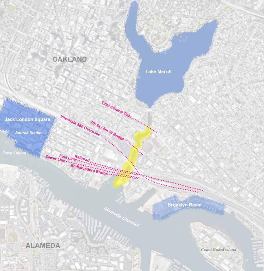
Because Channel Park is located downstream of the tidal control gates that maintain the lake’s water level, the site is subject to tidal flux in a way that Lake Merritt is not. Additionally, despite its close proximity to Lake Merritt, the site is disconnected from the spirit and activity of the area due to a series of infrastructural barriers imposed on the landscape over many decades. Railways, roads, pipelines, and the Interstate 880 overpass segment the landscape leading to Channel Park, isolating it as a metaphorical island in context with its urban adjacencies, and making it difficult to access for those traveling from surrounding areas.
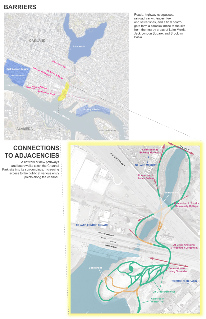
This landscape plan poses to stitch the Channel Park site into its surroundings and increase public access through a series of on-grade pathways and boardwalks.
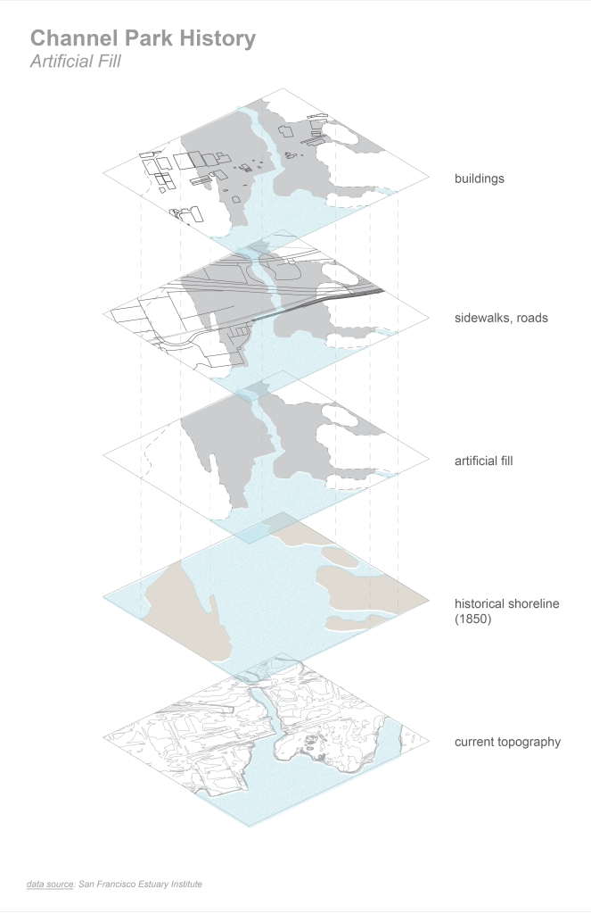
Prior to the filling and dredging of the bay that came with colonization of the 1800’s, this channel was historically wider and mainly consisted of rich and biodiverse tidal marsh. Looking forward, we can see that sea level rise projections predict that the channel will return to its historical state of inundation, overturning on the impermeable surfaces currently in-place, as is shown in this graphic.
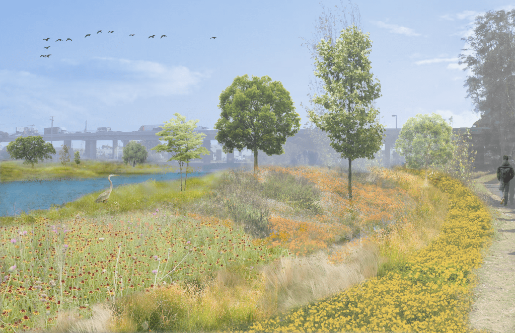
This landscape design aims to restore the channel to its natural state and use the natural processes of the rising and falling of the tides to invite a new dialogue between people, the water, and the land.
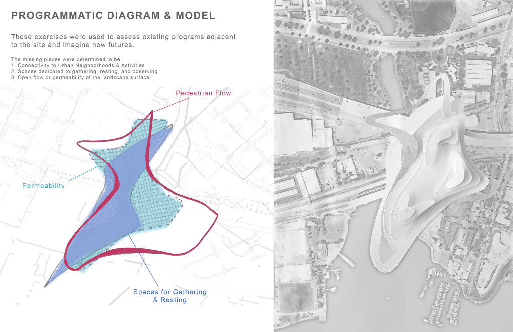
Models and programmatic diagrams were created to determine three key objectives for the project:
- Connecting to adjacencies and continuation of the Bay Trail
- Increasing permeability
- Creating opportunities for gathering and resting
These exercises explored what possibilities could be realized where the project goals overlap. The resulting approach imagined various patterns of grading and pathways intended to stitch the site into its surrounding context and provide a new and unique experience to interface with the water.
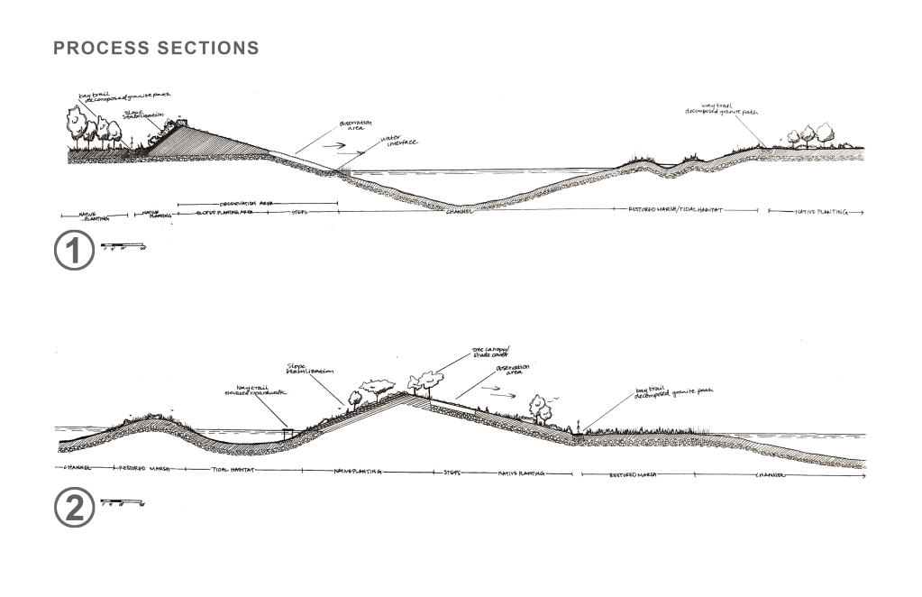
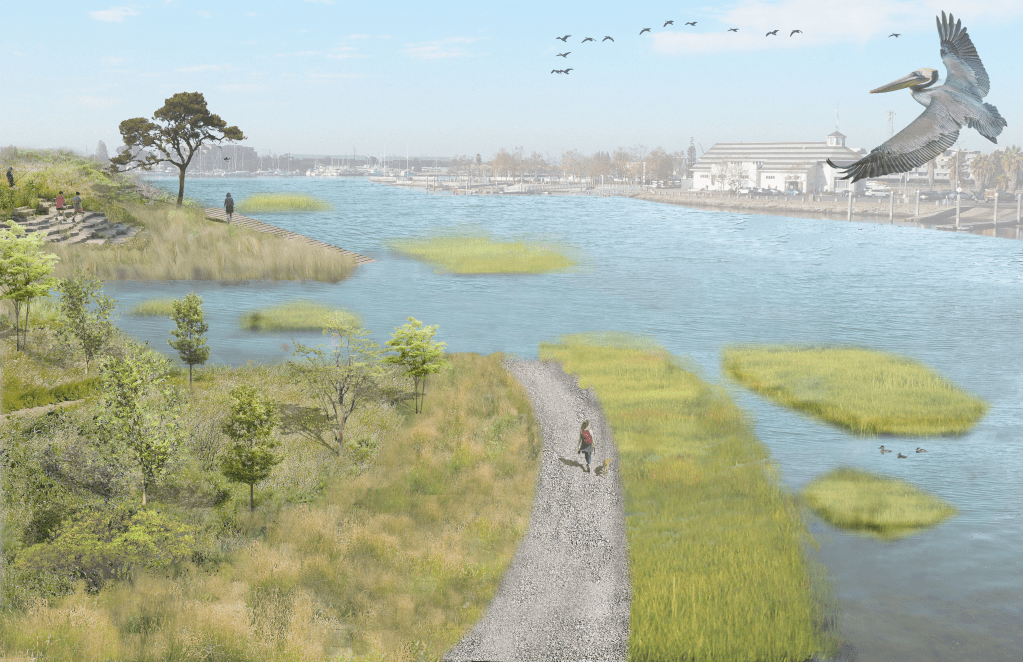
The first iterations imagined a series of landforms of varying heights, scales, and orientations that exist as a single landmass at certain points in the day. Tidal flux will alter the relationship throughout the day, and the landmass is transformed to an archipelago.
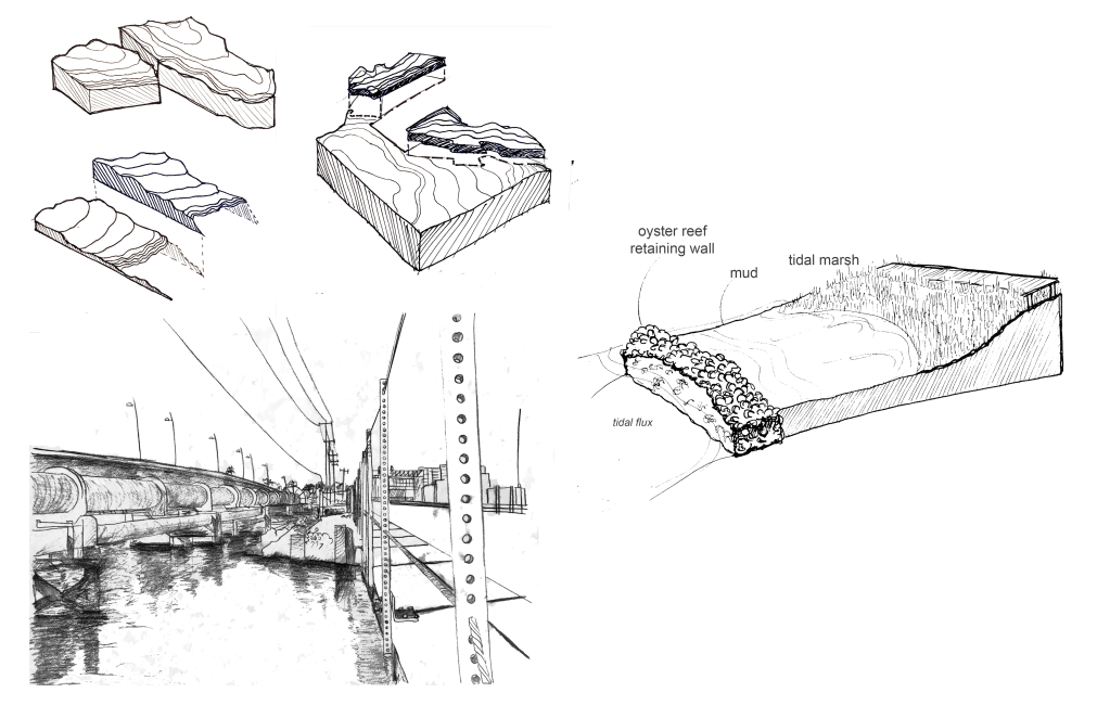
This is made possible through the implementation of oyster reef structures that act as retaining walls to define the island landforms and create habitat reserve for native species.
At low tide, the oyster structures may be revealed, followed by zones of mud, tidal marsh, lowland planting, and upland planting, as is exhibited in the plans below.
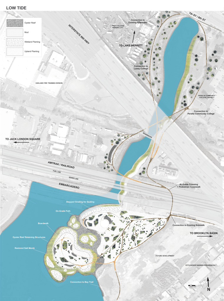
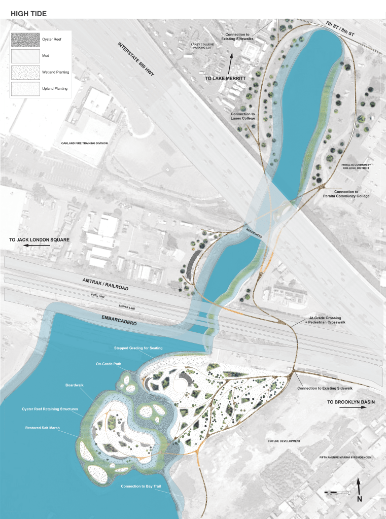
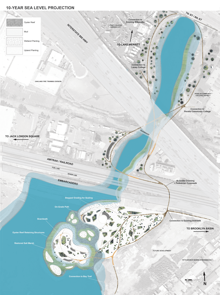
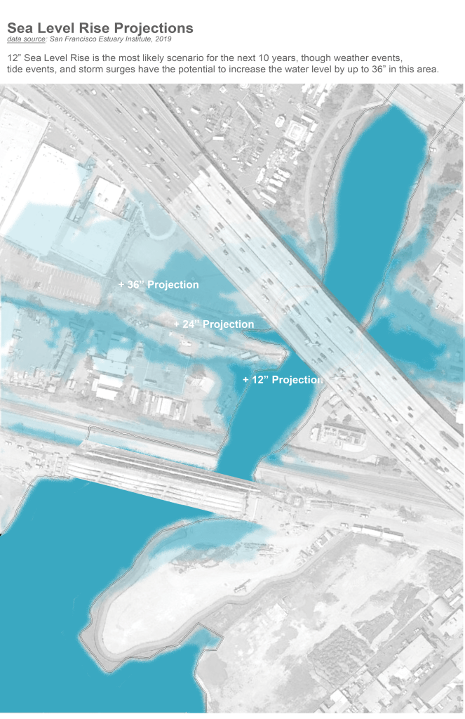
This is a flexible landscape that allows for up to 36” of further inundation with consideration to the 10-year sea level rise and storm surge projections for this area courtesy the San Francisco Estuary Institute.
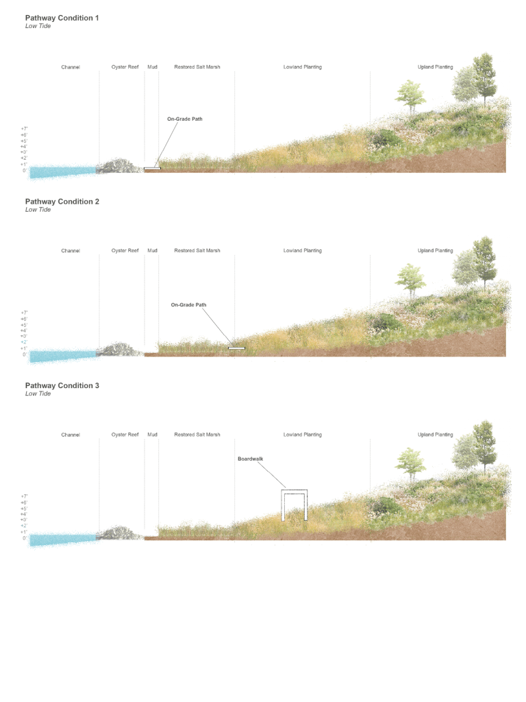
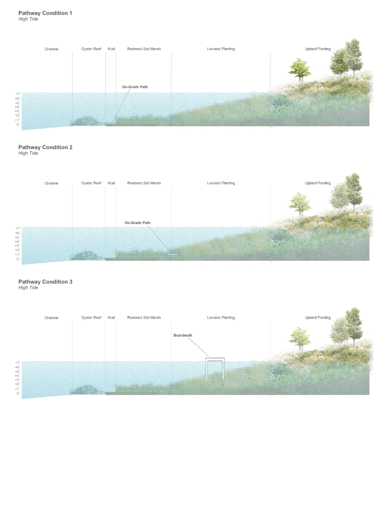
This landscape plan includes on-grade pathways and boardwalks that meander through the graded forms. The various pathway conditions offer different opportunities and means of access to certain islands depending on the time of day as tides allow. The multiple route options across the landscape encourage visitors to slow their pace, wander, and observe how it changes over time.
Channel Park is unique in its relationship and disconnection to its immediate adjacencies. This landscape has the potential to use the idea of the island – a symbol of Channel Park’s heritage as separated from its surroundings – to redefine its identity and offer residents the opportunity to move at a frequency defined by the natural processes of the tides, an escape from the urgency and hustle of modern life in the city, however brief it may be.
Sources:
- Historical Shoreline data courtesy the San Francisco Estuary Institute (SFEI)
- Oakland Inner Harbor Tidal data courtesy the National Oceanic and Atmospheric Administration (NOAA)
This project was created as part of L200A Fundamentals of Landscape Design studio led by Richard Hindle and Tomas McKay at UC Berkeley, Fall 2021 semester.
